Boer&Bunder introduces 2 new features on the website. It is now possible to view details of a ditch, and there is a predictive function for the next crop on a field.
Naast de gratis versie kent Boer&Bunder vanaf 2019 de Pro-versie die meer perceelinformatie weergeeft. “Het aantal functies gaan we fors uitbreiden”, legt Mark Gooskens uit. Hij is bij Dacom verantwoordelijk voor het Boer&Bunder platform.
"That's a small revolution for us, as some of those features come from other parts of the company."
"Think of disease models and the soil potential map. Instead of separate services, you will soon find these capabilities in Boer&Bunder Beta as well. This year, Pro users will have the opportunity to try out all new features for free. We keep an online list of all beta features we are testing. Later, we will decide under which subscription the new functionalities will ultimately fall."
Unique platform
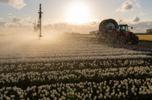
Mark doesn't beat around the bush: "During peak periods, the platform attracts 3,000 visitors daily. Most of them browse for free. To keep the system running and up to date, Dacom has to put in a lot of effort. Data also needs to be purchased. We hope that current free users are willing to pay a fair price. We deliberately avoid placing advertisements. This means that subscribers are leading. Boer&Bunder is optimally usable on both computers and tablets and smartphones. That's truly unique and it requires a lot of development." The platform has now expanded to other countries in Europe. After Belgium, it's now also available in France, Germany, Luxembourg, and Denmark. "Wherever the government provides open data, we try to display it reliably, clearly, and usefully. The type of data varies from country to country."
Zero input, max output
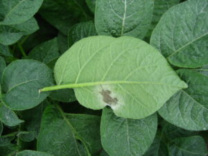
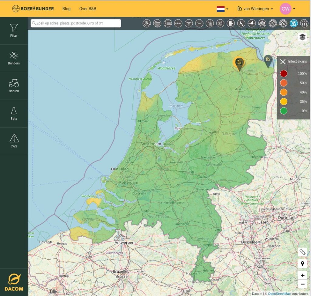
The first Beta feature being introduced is the Early Warning System (EWS). "The disease pressure models, actually the heart of Dacom," Mark knows. "You can see the infection risk at the field level over 5 days: yesterday, today, and three days into the future. To make it even easier for users, we're also working on simplifying the connection with RVO. Users will soon be able to retrieve their crop fields more easily via eRecognition. These are the field lines from your company registration with RVO and therefore exactly accurate. Users can also track fields via Boer&Bunder without using the RVO connection. This way, you get easy insight into infection risks. Handy when it's required for a sustainability certificate like Global Gap or Planet Proof. A perfect example of our Boer&Bunder vision: zero input and max output."
More field data
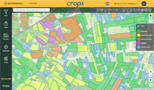
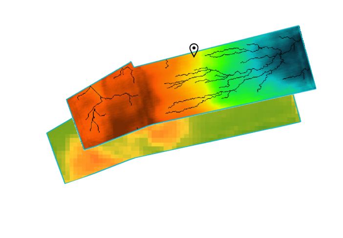
Those who want access to a range of plot data can use Cloudfarm. Boer&Bunder will serve as the entry-level model for this in the future. This means that, for example, the soil potential map and runoff map will also be displayed on Boer&Bunder. The quality of the satellite images will also become much more accurate. "The soil potential map is compiled based on 5 years of crop data," says Mark. "This provides a reliable picture of the productive capacity. Very useful for renting or leasing, where the application is often used. Based on the data, task maps can also be created. The creation of these remains reserved for Cloudfarm. The runoff map shows low spots and indicates where water drains away. Useful for preemptively laying drainage ditches and trenches.
Sharing fields
Sharing plots remains at the core of Boer&Bunder. Each field has a unique URL that can be shared. "Customer research shows that sharing is very important," Mark knows. "Not only for farmers and contractors but also for real estate agents and stewards. What's new is that you'll soon be able to create lists, so you can share multiple plots at once. Just like you can create playlists with your favorite music in Spotify."
Independent data
Dacom is renewing its focus on the social aspect of Boer&Bunder. Soon, users will be able to share parcels publicly if they wish. Thanks to the unique QR code, it will even be possible to mention the exact parcel on product packaging and add photos. This is great for those who sell directly to consumers. "This is how we continue to expand the platform," says Mark. "This year, the new beta features will be launched step by step. It's an ongoing process. The availability of reliable open government data is important to us. For example, annual national aerial photos are crucial. If governments don't do this, we are at the mercy of tech giants like Google, Microsoft, Apple, and Facebook for data.
"Let's cherish and make good use of the wealth of information that is now available."
"I look forward to all the feedback that will surely come on the new beta features."