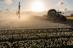
The use of task maps for site-specific work has increased by 35% in 2021. This is based on data collected by Dacom over the past growing season. Whether it's site-specific planting and seeding, fertilizing, or applying crop protection products, the use of task maps is on the rise. It's noteworthy that satellite imagery is increasingly being used to compile these maps.
In 2020, Dacom for the first time quantified how often task maps are used in practice, on what soil and for which application. Now that the 2021 season is almost over, we can draw conclusions based on practical data for this year. It turns out that the total number of task maps created with Dacom Cloudfarm has increased by 35%. Additionally, the number of users utilizing Cloudfarm to manage AB lines has significantly grown. This functionality was introduced in 2019. In total, nearly 25,000 AB lines have been created and exchanged among all known GPS providers.
Remarkable new crop
When the figures are broken down by crop group, it quickly becomes clear that potato cultivation is by far the most popular. This is not only due to the size of this crop, but also because of the earning potential. Savings or increased yields generally yield the highest returns. Following this crop are winter cereals, sugar beets, and onions. An interesting newcomer is the cultivation of turf grass, where site-specific work is increasingly common. There have been no changes in terms of soil type. Site-specific application is most common on sandy soil, followed by loam and light clay soil.
Many Cloudfarm users create about 10 task maps per growing season. For example, because the opportunity for adjustments during the cultivation process is limited. However, Lud Uitdewilligen, Cloudfarm product owner at Dacom, sees this trend shifting. "More and more farmers are working structurally with task maps. A quarter of them use the technology on a regular basis. The numbers show that many users are experimenting and exploring opportunities for their farms and crops."
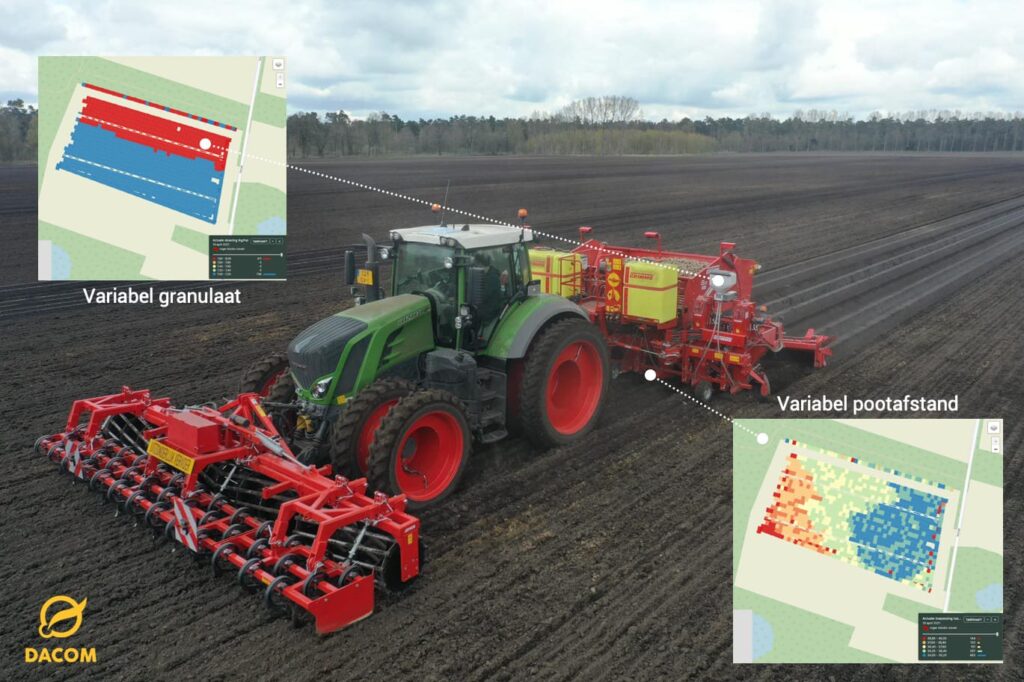
Top 6 most popular applications
The variability in potential gains is evident in the top 6 most used applications. Compared to 2020, this list remains unchanged. The following applications are the most commonly used:
1. Soil improvement for cultivation (applying variable compost or lime) 2. Varying the planting distance in potatoes 3. Variable application of liquid fertilizers in potatoes, sugar beets, and cereals 4. Variable application of granules (for nematode control in potatoes) 5. Top dressing based on satellite imagery 6. Variable soil herbicide spraying in onions
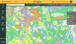
The difference in soil type emerges in this list. On sandy soil, variable liming is common, while herbicide spraying in onions on clay soil is popular. What stands out is that satellite imagery is the basis for nearly half of all applications. Uitdewilligen says, "Dacom has improved the accuracy of the images. The crop index is more precise due to the addition of the WDVI value. Growth differences in mature crops are more visible. By combining satellite data from multiple years, the Soil Potential Map is created. This newcomer was used by a growing group of participants in 2021. The newly introduced Observation Map is still relatively unknown but offers the possibility to manually mark weed spots and convert them into a task map.

Now thinking about task maps
"Now is the time to think about task map applications," emphasizes Uitdewilligen. "We see farmers encountering exchange problems too often during the growing season. A season can be quickly lost. By using the winter period to optimize the machinery and interchangeability, this can be prevented. Moreover, timely assistance can be sought from fellow farmers, dealers, or suppliers. Hopefully, these figures provide insight into the potential of working with task maps."
"At the same time, our focus remains on making task maps widely available to arable farmers. This should be reliable, user-friendly, and rewarding."
"Dacom is continuously working on the further development of Cloudfarm by improving user-friendliness and adding practical new functionalities. Working structurally with task maps requires the next level of automation," says Uitdewilligen. "Task maps are currently created one by one. Fixed templates can help to create task maps in bulk. Think of a regularly recurring phytophthora spraying."
New functionalities
New this season is the ability to combine task map layers. For example, to vary planting and apply granules. Something that new machines and terminals can handle. This feature will be further rolled out in Cloudfarm next season.
Also tested in 2021 is the Drainage Map. This automatically shows the lowest points in a field for the installation of drainage ditches. Furthermore, new is the Shade Map. This map layer shows the degree of sunlight radiation, depicting the shading effect of a row of trees.
Integrations
Not only the number of users, but also the number of connected manufacturers is growing. "We have integrated with Vervaet (yield measurement for sugar beets and chicory), BBLeap (spraying technology), and Raindancer (irrigation)," says Uitdewilligen. "There are more integrations in development. By improving the visualization of machine data, it is precisely shown how the operation was performed compared to the original task map. These are all examples of improving the user-friendliness of Cloudfarm." Curious about which task maps you can use on your farm to achieve immediate returns? Contact sales@dacom.nl. In Cloudfarm, you can easily create and export task maps to all commonly used brands of tractor and machinery terminals.