The GEO Irrigation project receives support from the European Agricultural Fund for Rural Development (EAFRD).
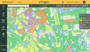
 In the GEO Irrigation project, project partners Irriwatch, Mts. Wollerich, Mts. Sterenborg, Mts. Wiertsema, and Siebring Akkerbouw are developing new user-friendly digital information products for growers, enabling them to gain better insight into the moisture needs of crops.
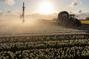
The majority, more than 70%, of available freshwater is used in the agricultural sector. Much of this is used for irrigating crops. There is a lot of waste in this process due to a lack of insight into the timing of irrigation, as well as a lack of understanding of the varying moisture needs within a field. Digitalization can make a huge difference here. This project focuses on linking data technology with more efficient control of farmers' irrigation systems.
The objective of this project is to deliver a prototype task map that accurately maps the moisture needs of crops at specific locations and automatically controls the irrigation system in the field.